In BYD’s marine series, the models named after marine animals are all popular in the door, and the models are excellent. They are the best in the sales rankings of their markets and are Internet celebrities in the consumer reputation. From seagulls to sea lions, the growth of the family has not only brought about the expansion of the model library, but also firmed the portrait of this series in the minds of consumers.
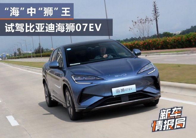
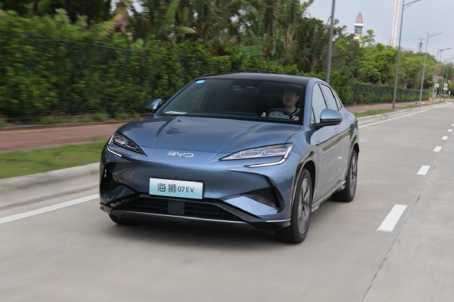
The latest bright color for this series is the EV that made its official debut at the Guangzhou Auto Show last year. The first model of this Sea Lion IP series comes with a new look, and it is also the first model of BYD’s e-platform 3.0 Evo. This "medium-sized urban smart SUV" defined by BYD will be launched at the end of this month. Before the official launch, we also had an early test drive experience for it.
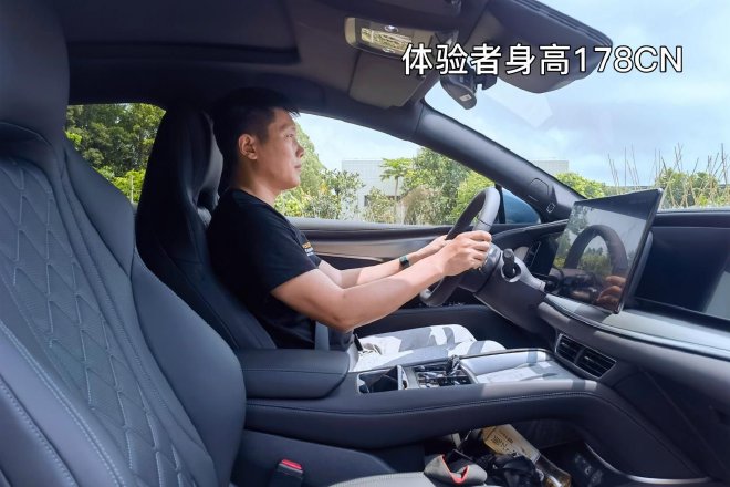
It is important to note that this time we are testing a two-wheel drive model, and it is still an engineering prototype. Some of the details of the loading hardware have not been finalized, and many on-board functions have not yet been opened, so it cannot fully represent the status of the final production car.
Previously, we launched a poll on Weibo for Sea Lion 07EV #to test with questions, and the three most votes were "How is the appearance and aura of the real car?", "Positioning the medium-sized SUV, can it play in space?" and "What are the highlights of the configuration?" Before the article begins, I will briefly answer here.
1. This is an Ocean Network model, so even in the photo, it has the "seafood" you can smell instantly. It continues the design of the BYD Ocean X concept car, but the DNA-like visual characteristics are not the most important thing. It is a mid-size SUV, but it uses a very unconventional and slippery body design, which is relatively rare in BYD models. So what about the aura? Let’s put it this way. It is actually quite sporty, but it does not come with too many sports kits. Instead, it uses a round design detail to create a futuristic aura with a sense of technology.
2. Its front and rear overhangs are very short, and the appropriate shaft length ratio shows the proportion of four wheels and four corners. In addition to the height and measurements, it has caught up with the size of the frigate 07, which determines that it can create a large interior space. Professional e-platform 3.0EVO and CTB battery body integration technology can also improve space utilization. However, its space is not simply large, but pays great attention to luxury. The center console design is complex, and the seat materials and filling are quite solid. Therefore, the actual space experience may not give you the spacious space you imagine in a rough car, but the space for five people is definitely more than enough.
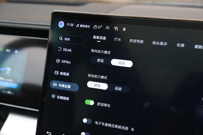
3. The official positioning of this car is "electric intelligence", so its configuration highlights are also unfolded here. Under the 3.0EVO liter dimension of the e platform, its electric intelligence is full-dimensional. First of all, the cockpit is the high-end version of the smart cockpit – DiLink 100, which supports 5G. Secondly, it is the first model of the "Eye of the Gods" high-level intelligent driver assistance system developed by Ocean Network, using the high-end intelligent driver assistance system of the Eye of the Gods – DiPilot 100. The iTAC intelligent torque control system is the second, and the last is the Yunnian-C system of the Internet celebrity, but we are testing a two-wheel drive model, and these two have not been experienced yet.
"Ocean smell" at a glance
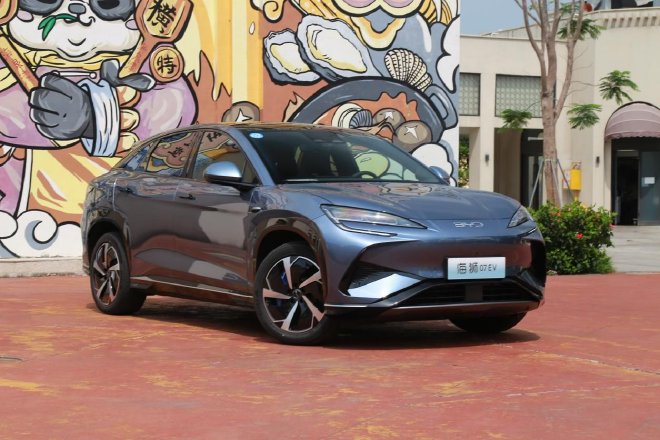
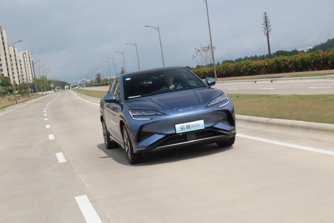
The exterior of the Sea Lion 07EV was created by a design team led by Wolfgang Iger, BYD’s global styling director. The whole car seems to have a very strong family identity, with flowing lines, intricately crafted and moving details, and many hidden marine elements Easter eggs. This is a car with a greater emphasis on mobility in design. The styling style of the family DNA has become more aggressive on it, and the dynamic style has come very significantly. It looks like a "running" feeling that has not been seen in BYD’s previous models.
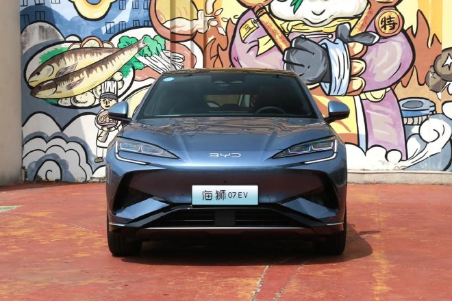
The front face part of the style continues from the Ocean X concept car design. The multi-layered X-shaped front face is full of fierceness. Here, bold lines are used for regional cutting, which enriches the layering and three-dimensional sense of the front of the car. Coupled with two raised tendons on the front cabin cover, the Sea Lion 07 EV presents a full visual explosion. The center of the front face of the car is gathered towards the BYD logo, and the visual center of gravity is gathered in the middle, which is very domineering.
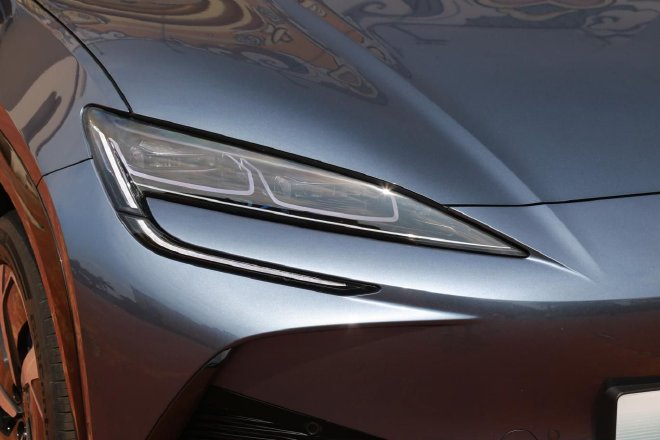
The shape of the Sea Lion 07EV headlight set is very consistent with the current marine car series, but the volume is obviously more narrow. The Haiyue double U floating headlight is also a highlight of the family design. The light-emitting unit suspended in the lamp cavity looks very technological. Below is a family-style split LED daytime running light. The light strip is swept back up to the corner of the headlight, and the boomerang shape is very modern. On the light source, the headlight set uses a matrix LED light source, which has a better lighting effect.
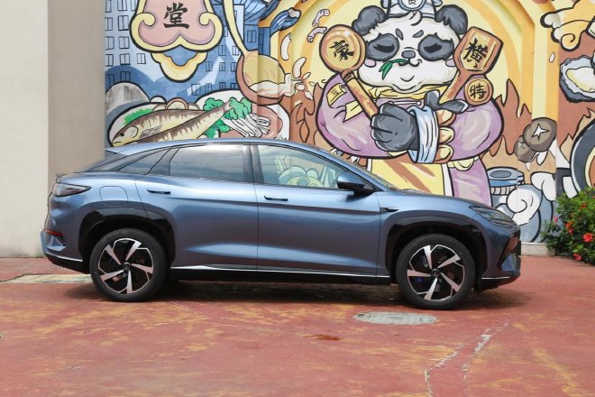
The Sea Lion 07EV is equipped with traditional frame doors and conceals the door handles. The side of the body is outlined with flowing lines, the window shape is relatively flat, the body clearance from the ground is small, and the body visual effect is relatively low. Its front and rear overhangs are very short, and the appropriate axle length ratio shows the proportion of the four corners of the four wheels. In terms of size, the body size is 4830/1925/1620mm, and the wheelbase is 2930mm. It is also considered a larger one in the current Ocean Net family.
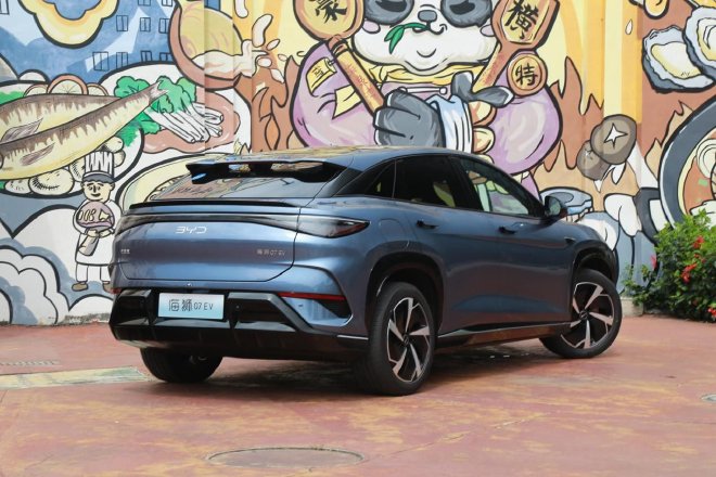
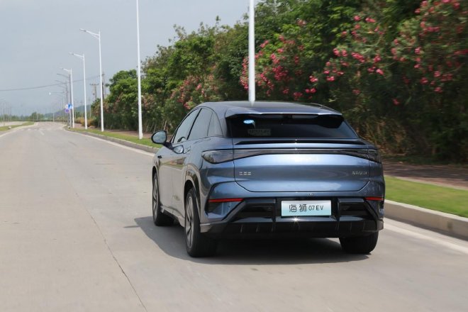
The retro-shaped triangular window design looks very harmonious. The chrome-plated decorative strips from the A-pillar to the D-pillar are integrated with the simple rear wing, showing a certain hunting SUV style. The underslipping roof line and ducktail make its rear part look very compact and dynamic. Its new car tail shape is also very sharp, but the three-dimensional surface is not rich, but it presents a simple beauty.
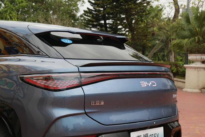
The BYD logo on the tail uses an evolved version of LED light-emitting technology for the first time, which can present a metallic texture and a semi-transparent state of light, and the details are particularly carefully designed. The tail light adopts a sea-sky line through the momentum tail light, which is like two water droplets under the action of surface tension. The width indicator light is like a splash of waves, and the recognition is also very high after lighting.
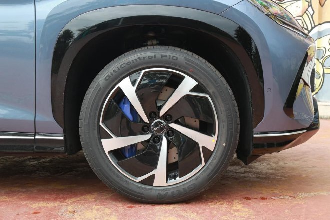
The shape of the thin-spoke Y-shaped wheel hub is very eye-catching, inspired by the posture of the sea lion leaping into the water, the large eyebrows and wheel hub create a very tense sports posture, and the brake calipers are painted blue. In terms of tires, it is matched with the 235/50 R19 Giti P10 tire, which combines performance and comfort.
The cockpit with the word "wisdom" in the head
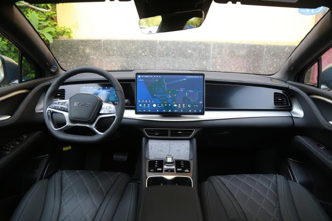
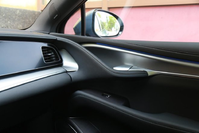
The family-style shape is naturally what the Sea Lion 07EV should have. Its style is not as cookie-cutter as many new forces, and it looks like it has a lot of thought. Like many new cars in the Ocean series, its central control area is a symmetrical double-layer suspended T-shaped design, but the overall lines are bold and the bending angle is very large, inspired by yachts. The family-style adaptive suspension Pad stands firmly in the C position of the center console and continues to be the center of gravity of the entire visual. In terms of interior materials, soft plastic and decorative strips, as well as the covering leather of the soft package, cover the entire center console. Only the bottom is a small place with hard plastic, and the material matching method is very good.
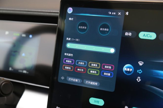
The circular strip of multi-color ambient lights traverses the entire center console, allowing you to manually adjust the color in the center console or follow the rhythm of the entire car, further enhancing the immersive experience.
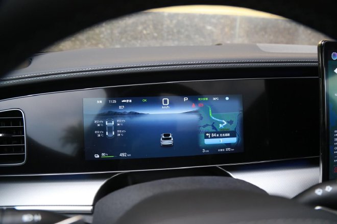
The 10.25-inch full LCD instrument panel has high contrast and clear display. The UI screen can be changed to different styles of display, and the navigation interface can also be displayed. Under normal conditions, the central interface can display rich information such as direct tire pressure monitoring information, driving range, energy consumption, navigation, and more.
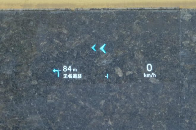
The AR-HUD head-up display is also equipped with a 50-inch projection area, higher brightness, and more intuitive dynamic display.
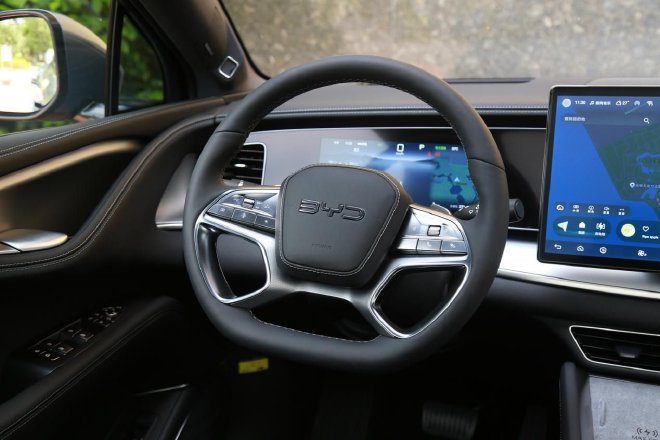
The new car adopts a new flat-bottomed steering wheel, and the intelligent control area is a simple double-layer suspension design. The wheel part adopts a three-dimensional double-hemmed, and the material is covered with the first layer of cowhide to ensure a good touch. Functionally, it supports up, down, front and rear four-way adjustment.
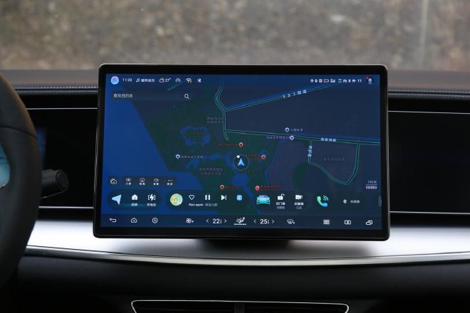
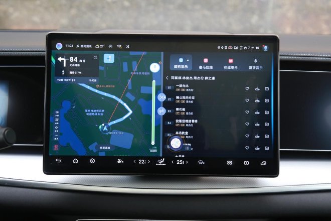
It is an "urban smart SUV", and the cockpit is the advanced version of the smart cockpit – DiLink 100. The 15.6-inch high screen ratio adaptive suspension in the center is the signature of the BYD family. This central control screen has a high resolution and excellent display effect. The picture is delicate and the display contrast is stronger. The interaction pattern also has a parallel window function and supports three-finger global gestures.
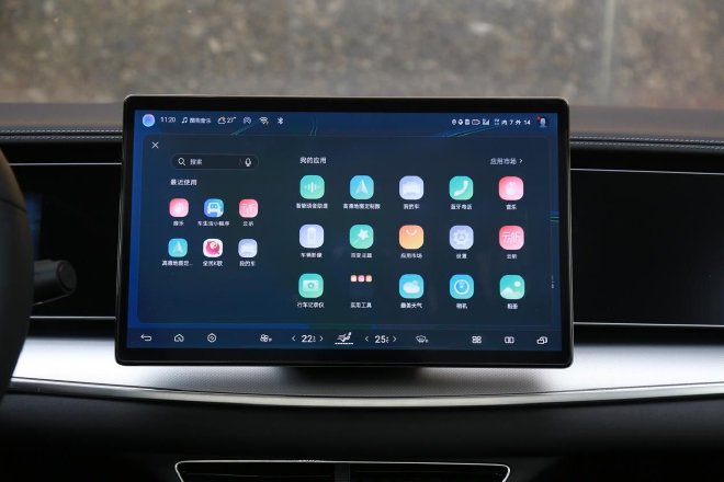
In terms of functions, the UI with the built-in DiLink intelligent network system is the basic style of the bottom tray plus the information tree that can be clicked on on the left. The entire UI interface is clean and minimalist, and a lot of work has been done on "going to the APP". In addition to the basic vehicle to everything application and the application mall with expandable functions, it also supports more advanced functions such as full-scene intelligent voice with four-tone zone recognition and OTA online upgrades.
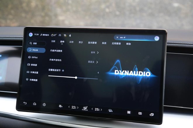
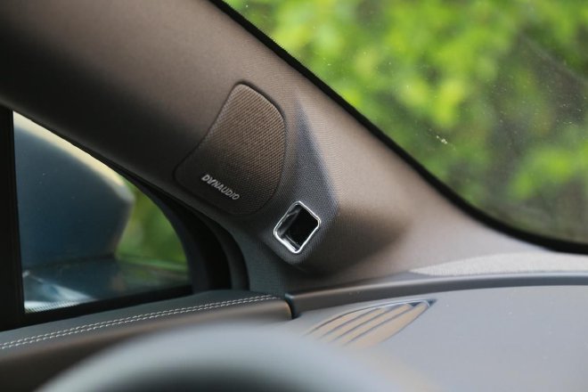
In the audio section, the test car is equipped with a HiFi-class 12-speaker Dynaudio. The speakers include treble, mid-range, bass, subwoofer, and surround sound. After being tuned by Dynaudio acoustics experts, this audio set can automatically adapt to different vehicle environmental conditions.
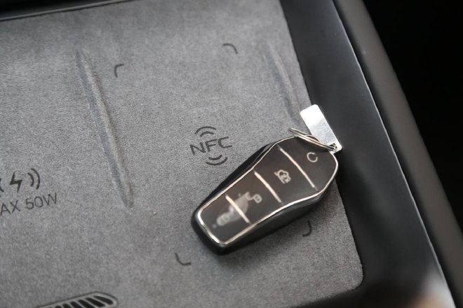
In addition to the traditional remote control key, it also supports smart APP, Bluetooth key and mobile NFC car key.
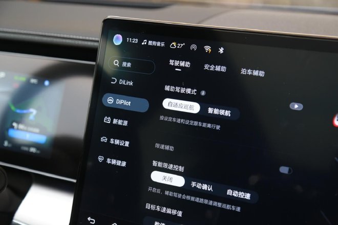
In terms of intelligent driving assistance, the Sea Lion 07EV is the first model of the "Eye of the Gods" high-level intelligent driving assistance system developed by the Ocean Network. This set of Eye of the Gods high-level intelligent driving assistance system-DiPilot 100 hardware includes 12 ultrasonic radars, 5 millimeter wave radars, and 11 cameras. It can realize high-level lever lane change and intelligent reminder. The follow-up full-scene intelligent driving high-speed navigation realized through OTA can realize automatic on and off ramp, autonomous lane change/overtaking, lane centering, intelligent speed limit control, and intelligent off-ramp selection.
There is a camera module on the driver’s side of the A-pillar. In addition to the ONE ID function, it also has a DMS recognition module. This smart cockpit can quickly identify the driver’s behavioral status through facial recognition and remind the driver to concentrate.
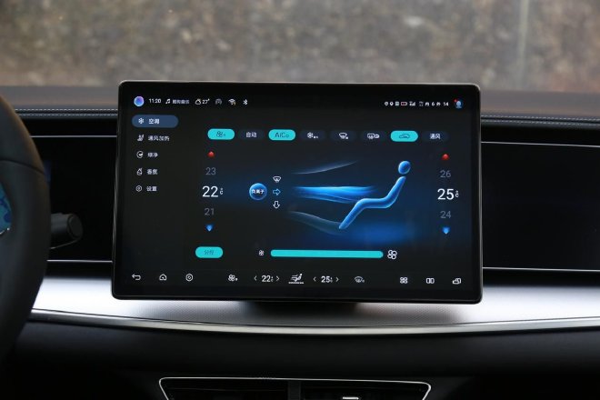
The new car is equipped with a new generation of intelligent wide temperature range high-efficiency heat pump system, which can not only efficiently adjust the temperature of the battery pack, but also control the temperature of the passenger compartment with low energy consumption as needed. The test car is equipped with dual-zone automatic air conditioning, the entire interface is integrated into the central control screen, and the temperature and air volume can be quickly adjusted through the three-finger sliding screen.
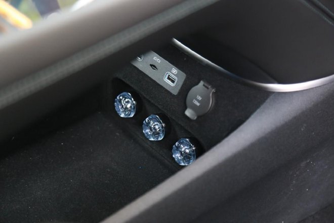
There are also translucent luminous electronic fragrance components at the bottom of the armrest to enhance the design.
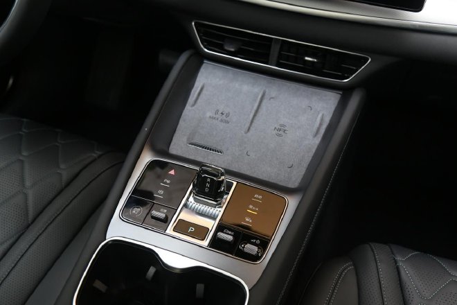
In front of the lower part of the center console is a large storage area, which is fully covered by flocking. The left side is the wireless charging area of the mobile phone with fan heat dissipation, and the right side is also the mobile phone storage area. After the storage area is the "Ocean Core", which is the control center of the Sea Lion 07EV, with a new shape of electronic shift lever.
Outside of the atmosphere, how is the space?
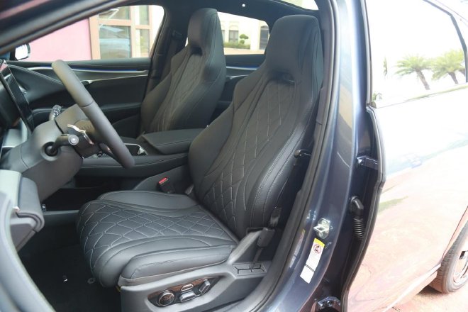
The seats of the test drive car use an integrated ergonomic seat with a hollowed-out headrest, but the quality is not blindly seeking "hard", and the comfort is what I want to give you the most. Its filling is soft and hard in the center, and the contrasting color design + stitching direction are very advanced. The front seats are adjustable from multiple angles, and the functions are equipped with massage, ventilation, heating and other functions. The mid-to-high-end models are also equipped with electric leg support adjustment functions.
Many of its interior details are inspired by marine life, and the interior door handle is also designed with a special door handle, which is very fresh and interesting.
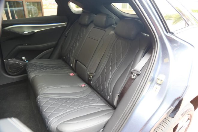
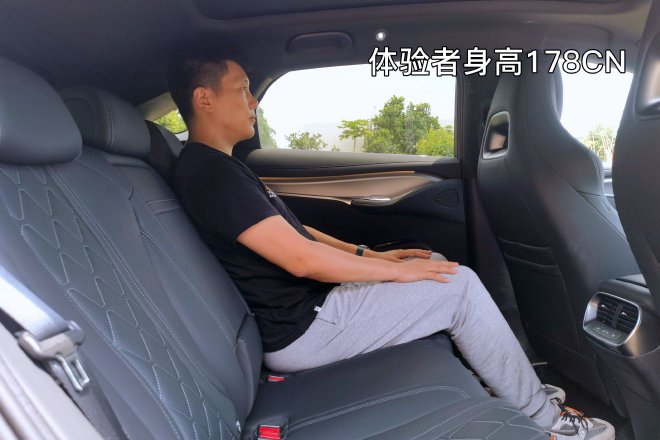
Benefiting from the CTB battery body integration technology, even with the shape of the backrest, the space in the rear is still a strong point, and the performance is ideal. The soft seats in the rear provide a sitting feeling that is not inferior to the front row, and the length of the seat cushion is also very good. The seat cushion filling takes into account comfort and support, and the three seats are very suitable for the occupants.
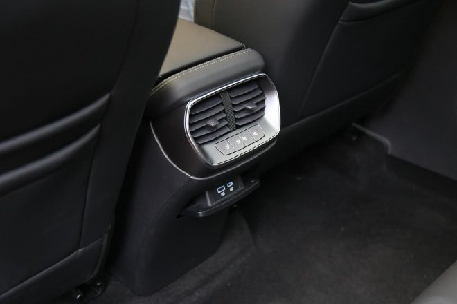
The rear row also adopts the central trend, and it is also equipped with a charging port synchronously, which is convenient for rear passengers to charge electronic devices.
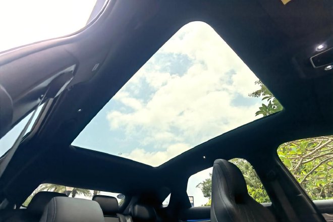
The canopy glass covers an area of 2.1 square meters, with a large viewing field and a sunshade. There is also a new generation of electrochromic technology on the high-end model, which provides 11-speed adjustment functions, which can block almost all ultraviolet rays and most of the heat.
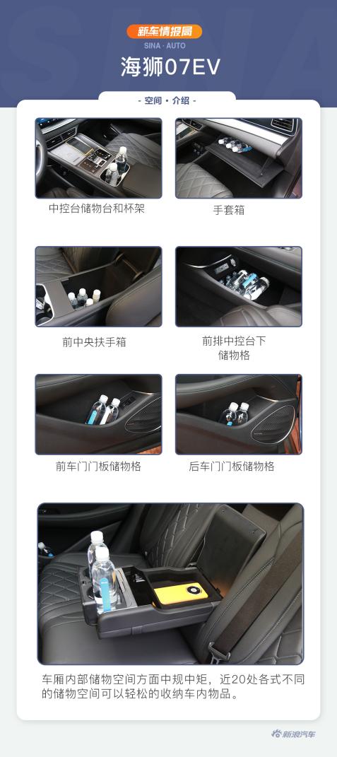
The internal storage space of the carriage is rather standard, with nearly 20 different storage spaces allowing for easy storage of items in the vehicle.
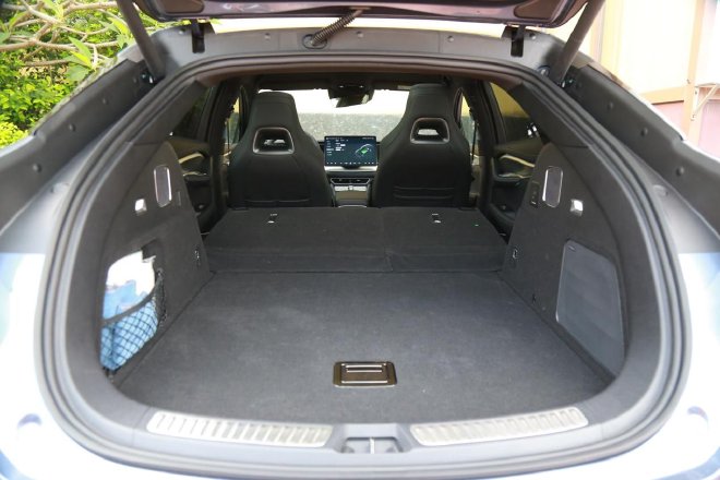
The new car is equipped with an electric tailgate with an opening angle memory function, and due to the design of the shape, its luggage compartment opening is relatively wide. The entire trunk space is a mainstream performance, and the regular shape of the trunk also improves a lot of efficiency. Under normal conditions, the volume is 500 liters. If you feel that the trunk space is not enough, the new car also provides a 4/6 split rear row reclining function, which can further expand the space to the level of 1769 liters.
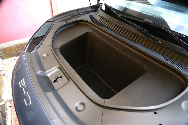
There is a good-sized storage compartment under the front cover, which can fit a 20-inch standard boarding case.
Advanced e-platform 3.0EVO, advanced driving control
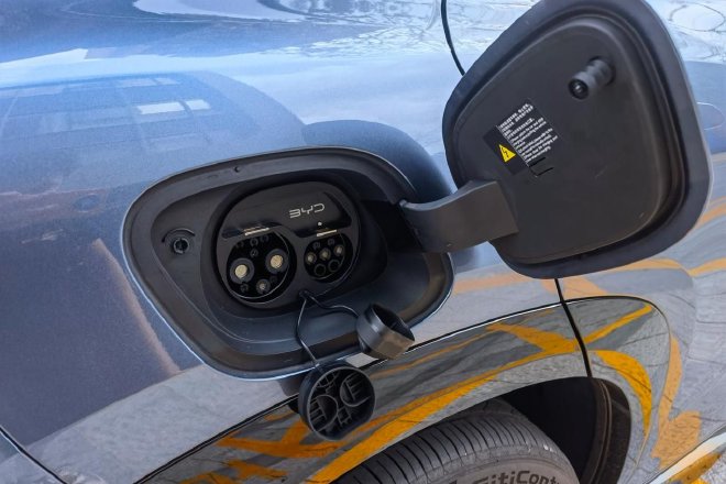
In terms of power and battery life, the Sea Lion 07EV is equipped with the world’s first high-efficiency 12-in-1 intelligent electric drive system, equipped with a 1200V silicon carbide power module, and the four-wheel drive model has the world’s highest mass-produced 23000rpm speed motor. The maximum power of the two-wheel drive version motor is 170kW/230kW respectively, and the cruising range is 550km and 610km. We tested the latter. The maximum power of the front and rear motors of the four-wheel drive version is 160kW and 230kW respectively, the comprehensive power is 390kW, the 100-kilometer acceleration time is 4.2 seconds, and the cruising range is 550km.
Our test drive model is a single-motor rear-drive model. For this body type, its horsepower is just right and there is a lot of surplus. When you get started, you can feel that the power synergy is very affinity, and there is no learning cost. As for the driving mode, the same is true. Classic economy, comfort, sports, with snow mode, each has its own unique flavor, but the character will not go to extremes.
Because of its good foundation, it is actually a machine that emphasizes the feeling of running. When driving a little excited, it gives you a quick and linear response. However, even if you drive faster, it is still far from its power limit. It can fully match your driving temper and mentality.
However, even if the power is strong, it will always pass on the comfortable side to you. It is always an SUV, and all the power-related equipment is for the passenger in the cockpit, so it gives you the same affinity as BYD’s other SUVs. As long as you don’t overly tease the accelerator pedal, its output characteristics are very friendly in normal driving.
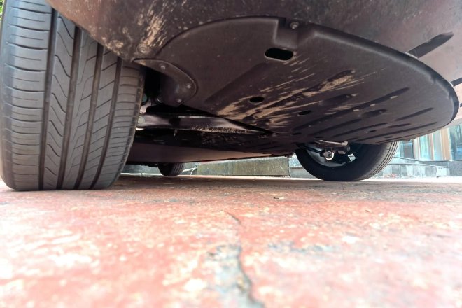
The chassis suspension adjustment of the Sea Lion 07EV also represents BYD’s understanding of comfortable passenger use. Its ground clearance is also relatively low in SUVs, with front fork arms + rear five-link suspension as the foundation. Its bottom is very good, and the vibration filtration in the face of large and small potholes is very clean. The shaking action of the body is very restrained. This is actually a car that is more family-oriented. It does not retain much of the feeling of getting off the wheel, but pursues a high-level sense of quality in driving.
The steering style is still relatively neutral, showing a more household state, the directivity is not heavy, the electronic taste is not heavy, the driving control has no learning cost, and it can be quickly adapted. The two modes can be adjusted with the speed damping gain, and the personality distinction is more obvious, but the affinity is always something that can give you.
Editor’s summary:In today’s highly competitive domestic pure electric SUV, it is not easy to create a popular model, the shape should be high value, the configuration should be advanced, the space should be spacious, the power should be abundant, the control should be stable and accurate, and the intelligence should be online, especially in the range of more than 200,000 yuan, but also in all the above attributes plus more skill points.
The BYD Sea Lion 07 EV we tested today is such a well-balanced model in all aspects. Facing the 200,000-level mid-to-high-end pure electric market, this is a model with outstanding skill points and no obvious shortcomings. Although the shape is sporty, the character is well balanced. Almighty, the strongest attribute I see in it.